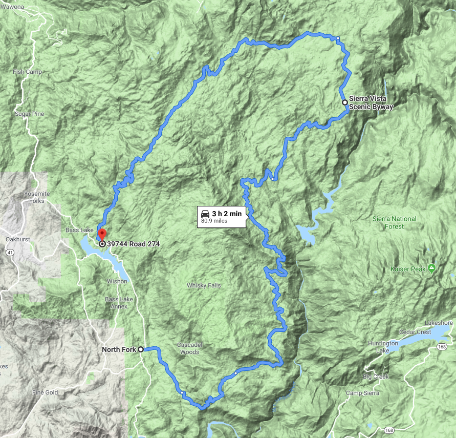
Sierra Vista Scenic Byway

The Sierra Vista National Scenic Byway meanders 100 miles through the Sierra Nevada Mountains and offers sweeping panoramic vistas of the Sierra Nevada’s granite peaks, lush meadows, a large array of plant and animal life, unique rock formations, historical attractions and more. The byway is a seasonal road and is maintained by the National Forest Service. It opens once all the snow has melted from the upper elevations and any necessary cleanup has been completed. Typically the best time to explore the byway is July-October (weather permitting). Much of the byway is at snow level and will not be accessible in winter months.

State Route 49 is a north-south state highway in the U.S. state of California that passes through many historic mining communities of the 1849 California gold rush. Highway 49 is numbered after the “49ers”, the waves of immigrants who swept into the area looking for gold, and a portion of it is known as the Gold Country Highway. This roadway begins in Oakhurst in the Sierra-Nevada mountains, where it diverges from State Route 41. It continues in a generally northwest direction, weaving through the communities of Goldside and Ahwahnee, before crossing into Mariposa County then continues northward where it reaches its northern terminus at State Route 70, in Vinton.

The drive shown follows the Sierra foothills through Mariposa, Sonora, Angels Camp and then north to Placerville.  A second days drive could continue up CA-49 to Auburn, Grass Valley and  northwards into the Sierras.

This drive stretches up out of the flat San Joaquin Valley and heads into the Sierra National Forest and the high Sierra Nevada mountains passing a series of picturesque lakes that came into being due to the need for electricity. In the early 1900s, the Big Creek Hydroelectric Project of the Southern California Edison Company built dams and tunnels, creating what are now known as the Edison Lakes. Today, vacationers flock here to relax amid beautiful high country scenery, enjoy water recreation, and hike trails for every level including the world-famous Pacific Crest or John Muir trails.

This is snow and ice country.  Check road conditions.  Tire chains should be carried and may be required at any time other than the hottest summer months.  High clearance, four-wheel drive vehicles are recommended to continue east past the end of CA-168.

This classic all day drive begins in Coarsegold winding its way north and upwards to the magnificent Mariposa Sequoia Grove at Yosemite’s South Entrance.  It continues north inside Yosemite Natl. Park with a side trip to the never forgotten Glacier Point and then down into the scenic wonders of Yosemite Valley.  In the Summer, consider continuing east up CA-120/Tioga road to the Tuolumne Meadows and then down out of the park to US-395.  Check road conditions in winter months.  Tire chains may be required and some roads may be closed.

The trip home from Yosemite Valley follows CA-140 along the Merced River Gorge down to Mariposa.  Finally we wind our way down CA-49 to Oakhurst and back home to Park of the Sierras in Coarsegold.

CA-400

A short local drive, California Road 400 has its northern origin on CA-415 then winds southwest  past Yosemite Lakes through woods and range land.  It follows along Coarsegold Creek past Hensley Lake until meeting CA-145 just outside Madera.

CA-415 Raymond Road

Another short local drive in the scenic Sierra foothills, California Road 415 originates at CA-41 in Coarsegold and winds westward the foothills to the quiet town of Raymond, CA.  The drive shown continues past Raymond on state roads CA-607 and CA-29 to the Eastman Lake Recreation Area.

CA-600 Grub Gulch Road

Scenic California Road 600 also known as Grub Gulch Road originates at CA-415 in Raymond, CA and runs northeast to end on Highway CA-49 just south of Ahwanee, California.